Those craving the scenery and crunch of golden leaves will ‘fall’ hard for these: our top picks of trails and routes for the best hiking in the USA. Whether you’re trekking solo or with your favorite walking companions, these scenic routes offer a beguiling way to explore the natural beauty of America.
From gushing waterfall walks and family-friendly routes to epic treks in the Great Outdoors, fall is the ideal season to get off the couch and immerse yourself in the wonder of Mother Nature. We’ve cherry-picked some of the best hiking trails in the USA to inspire you to get out and explore!
- Fall hiking trails in California
- Hiking trails in Los Angeles
- Colorado hiking trails to explore
- Top Tennessee hiking trails
- Florida hiking trails for fall
California hiking trails for fall adventures

Hiking in the fall is all about high-impact scenery and in this state, you’ll be spoilt for choice. With 300 state parks to explore, there are countless California hiking trails to suit all ages and abilities. Whether it’s lakes and mountains, redwood forests, or the ocean spray you crave, you’ll find your perfect fall hike here.
Best trails for scenic fall hiking in California
Parker Lake Trail on the June Lake Loop, Mammoth Lakes
- Distance: 4-mile round trip — Difficulty: Moderate
Awash with autumn color, the Eastern Sierra is a must-see destination in fall and one of the most breathtaking California hiking trails. The June Lake Loop is a signature trail for those looking to stay on Mammoth Lakes. This moderate hiking trail takes in stunning aspen trees, waterfalls, lakes, and dramatic mountain peaks. In addition, this trail is a great fit for families, with the opportunity to rent out a pedal boat at Gull Lake Marina and enjoy the views from the water. Start out from the trailhead parking at Parker Lake Road (at the north end of Highway 158). Walk along the aspen-lined creek and enjoy the switchbacks, the lake views, and the scenic walk down to June Lake Village.
Rubicon Trail, D.L Bliss State Park
- Distance: 9-mile round trip — Difficulty: Moderate
Those looking to stretch their legs in the Sierra Nevada will relish romping along the Rubicon Trail in the D.L Bliss State Park. This 9-mile round trip starts at Calawee Cove and leads for half a mile along steep cliffs, which plummet into the depths of Lake Tahoe, and, for mountain lovers, is some of the best hiking in the USA. Admire the lake views as you head south, spotting osprey nests, dramatic rock formations, and vivid green coves. After 4 miles you’ll reach the vista of Emerald Bay and the famous Fannette Island. Lake Tahoe’s only island offers a great photo opportunity and a chance to stop for a picnic. Once you’ve re-energized, make the 2-mile downhill descent from the D.L Bliss Visitor Center.
The ‘Four-mile Trail’, Yosemite National Park
- Distance: 9.6-mile round trip — Difficulty: Moderate to difficult
Hikers hoping to tackle a moderate-to-difficult-level trail will find the famous Four-mile Trail in Yosemite National Park delivers. From the valley floor, you’ll scale up the steep wall to Glacier Point, for awesome open views that feature some of Yosemite’s top sights. You’ll meander through the fall trees for the first mile, before ascending to the breathtaking viewpoints (the total elevation gain is 3,200 feet). This is one of the best hiking trails in the USA, as it features unbeatable views of some of America’s most iconic natural attractions. You can catch a glimpse of Yosemite Falls, Half Dome, and El Capitan. At Glacier Point, savor a (well-earned) ice cream from the visitor center, before making your descent. Those with sore feet may prefer to take the shuttle service instead!
Tanbark Trail, Big Sur
- Distance: 5.6 miles — Difficulty: Moderate
Those seeking a strenuous hike will enjoy the challenge of completing the steep route along Partington Creek. Along this trail, just 2 miles north of Julia Pfeiffer Burns pullout, you’ll be rewarded with a superb range of Big Sur scenes on what is one of the best California hiking trails along the Pacific coastline. From tanbark oaks and redwoods to ferns, boulders, and canyons. After walking past the old Tin House (c. 1944) and along a steep fire road, you’ll be met with breathtaking views of the Pacific Ocean and Highway 1. Now ‘Cali’ views don’t get much better than that!
California hiking trails with waterfalls
The sights and sounds of a gushing waterfall along a trail will appeal to many seasonal hikers. Though most waterfalls are best visited in spring (when the snowmelt brings a deluge of water down), there are some scenic California hiking trails with waterfalls that you can still soak up in the fall, crowned by a blaze of orange, red, and golden leaves.
Big Sur Pfeiffer Falls
- Distance: 1.3 miles — Difficulty: Easy
After a 13-year-long restoration, the Pfeiffer Falls trail is now firmly back on the map of top waterfall hikes in California. This year-round trail is perfect for mixed abilities. The revamped route invites you to walk under the shade of the coastal redwoods and includes 200 steps, with a vertical elevation gain of 500 feet. You can avoid these steps in favor of a gradual slope, by taking the trail clockwise via Valley View. There’s also a new 70-foot-long wooden bridge to cross, which kids will love. Although not the most impressive waterfall, it is a charming view when the spring-fed Pfeiffer Falls come into view. Head to the new observation deck and treat yourselves to ice cream at The Lodge, which offers indoor and outdoor seating.
Salmon Creek Falls, Big Sur
- Distance: 1/4 mile-round trip — Difficulty: Easy
Start at the pullout 3.6 miles north of Ragged Point (45 minutes south of the Pfeiffer Big Sur State Park entrance) and follow the trail signs. This short, scenic hike leads to the beautiful 120-foot waterfall at Salmon Creek. For those with more energy to burn, why not tackle the entire 10.9-mile trail? You’ll experience a total elevation gain of 6,063 feet, not to mention a super introduction to the epic possibilities of the Silver Peak Wilderness!
Eagle Falls Vista Point Loop, Lake Tahoe
- Distance: 0.62 miles — Difficulty: Easy
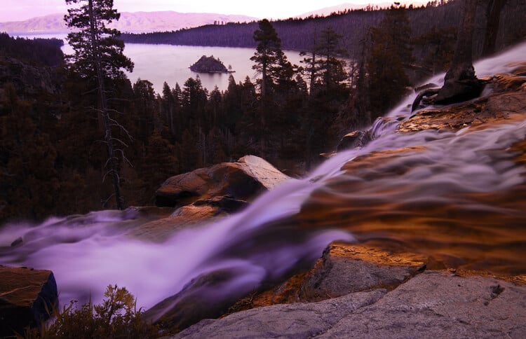
Families with kids can make the most of this short loop trail on South Lake Tahoe. Ideal for all abilities, the popular hiking trail features a gentle ascent across stone steps into the rock wall. Here you’ll enjoy one of the most scenic views across the Lake Tahoe basin. Take in the cascading Eagle Falls, which is surrounded by evergreens, large granite peaks, and the beautiful Emerald Bay below. For those with some unspent energy, continue upwards on the trail. You’ll be rewarded with the majestic sight of Eagle Lake. Remember to grab a Desolation Wilderness permit from the trailhead, before making the ascent.
Rainbow Falls, Mammoth Lakes
- Distance: 2.5 miles — Difficulty: Easy
From the trailhead at Devil’s Postpile National Monument, head out into the John Muir Wilderness along this wide, sandy trail. Enjoy spotting the highest waterfall on the Middle Fork of the San Joaquin River. This 100-foot waterfall is aptly named Rainbow Falls, due to the way the mist often creates colorful rainbows. With an elevation gain of just 300 feet, it’s an easy trail for waterfall seekers. Those looking to continue on can take the lesser-worn path down the riverside to Lower Falls. Alternatively, more ambitious hikers can head back to the trail junctions for the John Muir and Pacific Crest trails.
McWay Waterfall Trail, Big Sur
- Distance: 1/2 mile — Difficulty: Easy to moderate
Offering a rich variety of Big Sur landscapes, from canyons and redwoods to ocean vistas, this short trail also promises an 80-foot waterfall! Watching the water gush directly onto the beach below is an awesome sight. Start out at the Julia Pfeiffer Burns State Park parking lot (37 miles south of Carmel). Although the main route is a short, moderately easy trail, you can lengthen your hike, by following signs for the Pelton Wheel trail.
Cascade Falls, Lake Tahoe
- Distance: 1.4 miles — Difficulty: Moderate
This popular out-and-back hiking route on South Lake Tahoe is perfect for families with older kids. Your pet pooch is also welcome (when kept on a leash). Find the trailhead just off Highway 89 in the Emerald Lake State Park, north of South Lake Tahoe (across from Inspiration Point). Although there’s little elevation gain, the varied hiking trail meanders through an autumnal forest and across stone steps. There are also some large boulders to navigate in places. Along the way, take in the open vistas of Cascade Lake, the turquoise waters of Emerald Bay, and the jaw-dropping beauty of Lake Tahoe. Once you’ve reached Cascade Falls, reward yourself with a moment here. Enjoy some lunch and a cooling foot bath, in one of the natural pools.
Trails for fall hiking in Los Angeles
Aside from being a global melting pot of cosmopolitan diversions, the ‘City of Angels’ is also home to some highly scenic hiking trails. Perfect for hikers of all abilities, these serene trails allow you to enjoy a different side of Los Angeles.
For those looking to experience the ultimate LA vacation, our luxurious homes in LA and Beverly Hills place you in a prime location for a 5-star stay.
Oak Glen Preserve hiking trail, Yucaipa
- Distance: 1.8 miles — Difficulty: Easy
This sunny trail near Forest Falls is a popular choice for families. The route lets you take in wildflowers, a lake, and the timeless beauty of the Great Outdoors. Dog walkers are also welcome, as long as pooches are kept on a leash. Afterward, you can enjoy the local attractions of Oak Glen, which include a Botanical Garden and Children’s Outdoor Activity Center.
For hikers who enjoy a cardio burn, the 3-mile climb from Oak Glen Preserve to Preservation Point is a great alternative. This alternative loop trail is relentlessly steep and sunny in places, making it a difficult yet worthwhile challenge. You’ll be able to take in river views and spectacular fall scenery along the way too.
Sostomo and Deer Valley Loop Trail, Malibu
- Distance: 6.3 miles — Difficulty: Moderate
Located in the Santa Monica Mountains Recreation Area, this moderate-level hike is great for walkers looking for varied scenery. It’s also a good choice for dog walkers (dogs though must be kept on a leash). For those trying to avoid the sun, start out early and head anti-clockwise along the Rising Sun Trail. Parking is available at Solstice Canyon Road. Along the elevated loop, you’ll be able to take in local birdlife, canyons, the ocean, beaches, and a waterfall. For the ultimate vantage point, continue on past the waterfall for another 0.3 miles.
Best places for hiking in Colorado
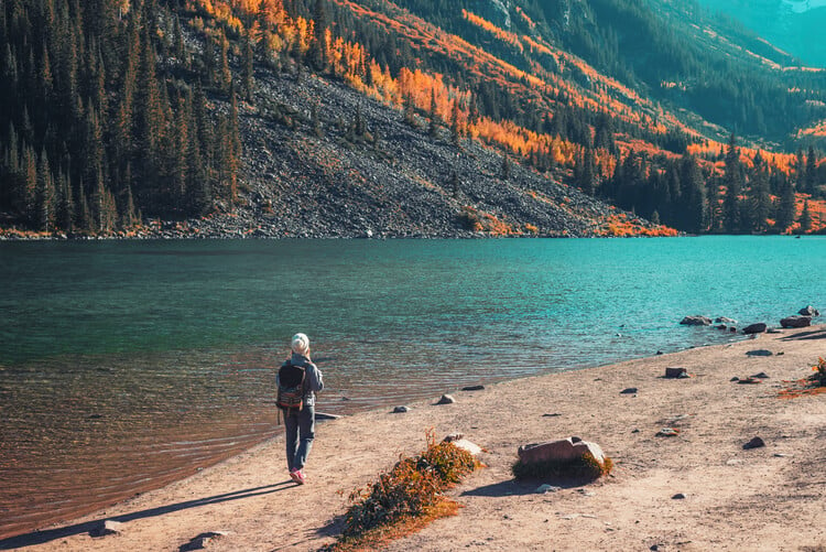
The Rocky Mountains in the state of Colorado are synonymous with great hikes. Visit from mid-September to October, so you can take in the colorful riot of fall foliage on the aspen trees.
For active visitors looking to stay in Colorado, our vacation homes are perfectly placed for hiking, skiing, and enjoying the plethora of year-round activities on offer.
The Maroon Bells Lake hiking trail, Aspen
- Distance: 3-mile round trip — Difficulty: Easy to moderate
This popular Aspen hiking trail is even more impressive in the fall when you’ll gaze at the reflection of colorful aspens in the lake as much as the photogenic mountain peaks! Located in the Maroon Bells – Snowmass Wilderness, dogs are permitted along the trails (as long as they’re kept on a leash), making it the perfect choice for the whole family. Hikers arriving between the hours of 7.30 am and 5 pm must take the bus to Maroon Bells. Hikers arriving outside these hours can drive to the end of Maroon Creek Road and park.
From the car park head west and enjoy the scenic Maroon Bells lake trail, as the two ‘Bells’ come into view. Aside from the majestic mountain peaks, you’ll also have the stunning autumnal scenery for company. When crossing the first bridge, stick to the trail on the right — for more lake, aspen, and river scenery. After the next bridge, you can choose to descend back down to the car park or carry on through the aspen forest.
Moraine Park Loop, Rocky Mountain National Park
- Distance: 5.5 miles — Difficulty: Easy
Seeking an enchanting hike in the Great Outdoors? If so then walking the vast valley space around the golden meadows on the Moraine Park Loop is for you! Take in distant views of the Rockies and look out for the native wildlife, ranging from moose and elk to mountain goats and Abert’s squirrel.
To begin your hike, you’ll reach the Moraine Park trailhead from the Discovery Center. Coincidentally, the Discovery Center offers a great opportunity to learn about the region before you go on and explore. Follow the route clockwise around the outer rim of Moraine Park. Once you’re at the breathtaking meadow you may prefer to opt for the safer paths which meander through it, rather than sharing the road with cars. In fall, look out for sparring bull elk, as they bugle to win the mating rights of the herd.
Cross Bear Lake Road and head west along South Moraine Road, to pick up the South Moraine Trail. Take in the scenery and enjoy the shade as you reach the Cub Lake trail. To continue on the loop head right/north along this trail and cross the Big Thompson River. At the Cub Lake trailhead, continue right/east along Fern Lake Road. When the road finishes at Moraine Park Road, head right/east to loop back around to the Moraine Park Discovery Center.
The Baker’s Tank and Borese Pass hiking trail, nr Breckenridge
- Distance: 5.1 miles — Difficulty: Moderate
Perfect for catching the vivid fall colors, this Colorado hiking trail offers captivating views of aspens as well as across Breckenridge, the Ten Mile Mountain Range, and the Blue River Valley. Start out at the Baker’s Tank trailhead and walk back along the road for the best scenery. Although this 5.1-mile hike is seen as moderate, with an 882-ft elevation gain, you can choose to walk as much or as little of it as you like. The savviest hikers begin their hike in the early morning, to avoid the traffic. Dogs are also allowed along the trail — enabling the whole family to enjoy the Great Outdoors. Spot grouse and moose in fall and if you’re hiking outside of this season look for the beautiful wildflowers.
Choose to hike this trail or the entire 20 miles of the point-to-point Boreas Pass trail. Alternatively, hop in your car and take in an aspen-lined road trip to find the most scenic sections!
Top Tennessee hiking trails
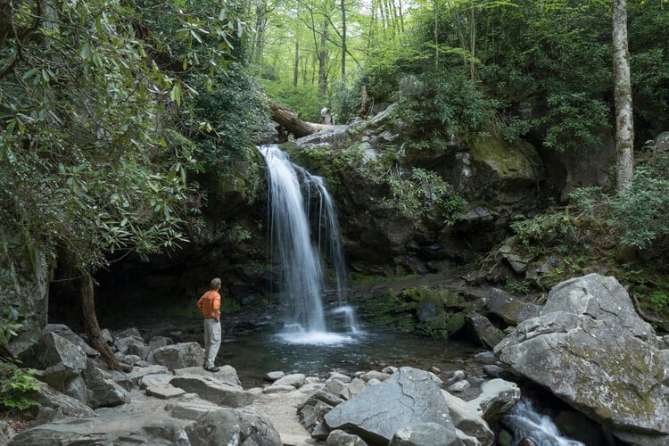
One of the best states for fall color has to be Tennessee. In particular, the Great Smoky Mountains National Park. Within the vast 522,427-acre park, you’ll find a plethora of hiking trails to tackle during the fall. Each one offers the opportunity to immerse yourself in the rich color palette of sugar and red maples, hickories, sweetgum, and scarlet oaks. Epic fall colors reach their peak here between mid-October to early November along the mid and lower elevations, so pick this time to visit the park trails. For the best scenery, pick the higher elevation trails and take in the fall colors from above!
Abrams Falls Trail, Townsend
- Distance: 4.2 miles — Difficulty: Easy to Moderate
Placed just 30 miles from Pigeon Forge, this day hike is one of the most popular hiking trails in the area. Its inclusive year-round appeal makes it a great choice for hikers and nature lovers staying in the popular mountain resort. You’ll find the trailhead located off the 11-mile Cades Cove loop trail. The easy hike and bike paths along Abrams Creek are great for families, with breathtaking fall color and the Abrams Falls to take in along the way. Picnic lunch aside, expect the 8.4-mile round trip to take 3 to 4 hours to complete. The 675-feet elevation gain is gradual, making it a pleasant undertaking rather than a challenge.
Little Greenbrier Trail, Wears Valley
- Distance: 4.3 miles — Difficulty: Easy to Moderate
This varied woodland trail intersects with the Little Brier Gap trail and the Laurel Falls trail, making it the perfect excuse for getting out and exploring the ‘Smokies’. Start out at the Wear Cove Gap Road trailhead and enjoy the fairly steep trek, with an elevation gain of 1,883 feet. As well as the exuberant fall foliage found in the woodland, you’ll enjoy some great vistas along the way. There are also some intriguing points of interest, including the historical farmstead known as the Walker Sisters Place, in nearby Sevierville (reached via the Metcalf Bottoms trail).
Appalachian Trail, Great Smoky Mountains
- Distance: Up to 71 miles + — Difficulty: Moderate to Difficult
No trail in Tennessee says ‘Smoky Mountains’ more than the Appalachian National Scenic Trail (known as A.T.). The A.T. is the longest hiking-only trail in the world — at 2,190 miles. The picturesque route sees 71 miles coursing through the Great Smoky Mountains National Park. There are also 160 more miles running along the Tennessee/North Carolina border.
Hikers can expect to spend a minimum of 7 days along the Smoky Mountain section of the trail, although shorter 3-4 day hikes are possible when using Newfound Gap or Clingmans Dome as a mid-point. The epic one-way trail is signposted by ‘blazes’ painted on posts, rocks, and trees. For the most breathtaking fall views, go for the trail with the highest point and take the trail via Clingmans Dome. From its 6,643-ft elevation, you’ll be able to marvel at the early fall color and take in the epic scenery of Tennessee. Just remember to bring some extra layers if you’re heading to Clingmans Dome! The epic trail requires hikers to stay at designated sites along the way and to obtain an advance permit from the Great Smoky Mountains National Park.
Amazing places for fall hiking in Florida
As well as world-class theme parks and beaches, Florida is also home to 175 State Parks — many of which offer fantastic hiking trails. Although not home to high-elevation panoramas, Florida features a plethora of landscapes you can immerse yourself in. From wide prairies and shady canopies to Jurassic-like tropical worlds, come and spot the unique wildlife, flora, and fauna. Ancient cypress trees and rare orchids await whilst alligators, wild horses, and bison can all be spotted in Sunshine State. The best hiking is from November through to April, or up in the north from October to May.
East Main Trail, Fakahatchee Strand Preserve State Park
- Distance: 2 miles+ — Difficulty: Easy to Moderate
Set in the largest state park in Florida, you’ll find endless hiking trails here. Created from former logging roads, the paths are perfect for easy hikes through cypress forests. Look out for wild orchids and the elusive Florida panther. This easy 2-hour trail starts at the end of the driveable section of Jane’s Scenic Drive. Walk the trail until you reach the old lakeside cabin comically named ‘Fakahatchee Hilton’. Explore the boardwalk which connects the private cabin to the water and enjoy a peaceful picnic here. If you’re with the kids count how many alligators you can see!
Myakka Trail & Canopy Walkway, Myakka River State Park
- Distance: Up to 39 miles — Difficulty: Easy to Moderate
Within easy reach of Sarasota in South Florida, this 39-mile hiking trail invites avid walkers to explore the vast central prairies of the Florida peninsular. Set in the heart of a 37,000-acre State Park, explore a myriad of different habitats across 4 trail loops — from shady oak hammocks to expansive grasslands.
One of the most popular loops is the 0.9-mile William S Boylston Nature Trail. This varied and lightly trafficked loop trail meanders through the Myakka River State Park under the shade of tropical hammocks and across open boardwalks. Another popular highlight is the Myakka Canopy walkway. The first public treetop trail in North America allows visitors to see up close the local habitants of the impressive oak and palm canopy. Suspended 25-feet in the air, there are 100 steps to negotiate first, before exploring the 100-feet long walkway. Although not a traditional ‘trail’ the walkway offers a unique and memorable stroll!
Book with Top Villas
Feel inspired to book a vacation home for your hiking holiday? Rest assured, whether you’re looking to stay in the fall or another time of year, you’re guaranteed a first-class service with Top Villas.
Our exclusive villas, townhomes, condos, and cabins all promise a luxury vacation. You’ll find our Guest Experience team also on hand to help enhance your stay, with a plethora of amazing Travel Extras.
What’s more, we make payments a breeze. Our new Affirm credit payment option* means you can spread the cost of your vacation rental over a 3, 6, or 12-month period. Simply look out for properties with the Affirm banner.
*Subject to meeting Affirm’s credit criteria. T’s & C’s apply.

